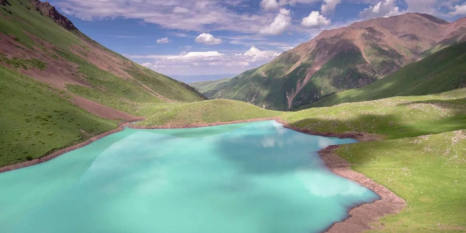
 Image via GetYourGuide
Kol-Tor Lake Guide: Turquoise Hike from Bishkek
Kol-Tor is a vivid turquoise lake in the Kegety gorge, hiked as a hard day trip or overnight roughly 2–3 hours east of Bishkek. Here's how to reach and walk it.
Book it on This is Kyrgyzstan
Bishkek · Turn this guide into a trip

Kol-Tor (Köl-Tör, "lake valley") is a small, intensely turquoise lake tucked into the Kegety gorge, roughly two to three hours' drive east of Bishkek. You reach it on a steep out-and-back hike from a rough road head at the top of the gorge: about 14 km return, 700–900 m of climbing, and five to seven hours on your feet. Most people do it as one long day from the capital; a few carry a tent and camp by the water. It is one of the most rewarding hikes you can pull off from Bishkek without committing to a multi-day trek.
One thing to settle before you plan anything: this is the Kegety-gorge Kol-Tor in Chuy province, near Bishkek — not the Köl-Tör that sits above Kol-Ukok near Kochkor, in Naryn province, which is a different lake reached on a longer horse-and-hike route entirely. The two share a name and both are glacial and blue, so search results and old blog posts muddle them constantly. Everything below is the Bishkek day-hike version.
At a glance
| Drive from Bishkek | ~2–3 hours to Kegety village, then a rough 4WD track up the gorge |
| Trailhead | The upper Kegety gorge road head (high-clearance/4WD only) |
| Hike | ~7 km one-way, ~14 km return |
| Time on foot | 5–7 hours return |
| Altitude | road head near 2,000 m up to the lake at about 2,700–2,800 m (sources differ) |
| Difficulty | Moderate–hard |
| Best months | Late June to September |
| Permit | None needed |
Where Kol-Tor sits
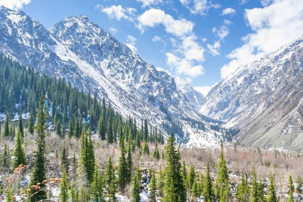
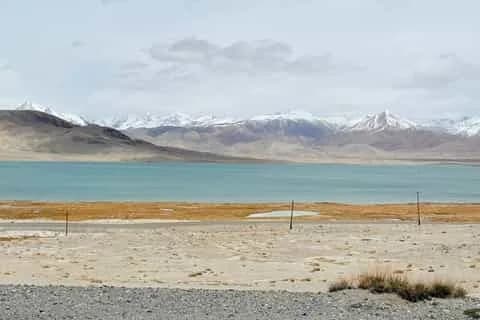
The lake lies in the Kegety (Kegeti) gorge, one of the deep valleys cutting south into the Kyrgyz Ala-Too range from the Chuy plain. The Kegety river runs the length of the gorge; Kol-Tor hangs in a side basin above it, dammed behind an old moraine, fed by snowmelt and glacial trickle. That glacial input is what gives the water its colour — fine rock flour in suspension that turns the lake milky pale under cloud and a hard turquoise-teal in direct sun. It is a genuinely striking sight, and small enough that you can walk most of the shore in twenty minutes.
Sources put the lake at somewhere between about 2,700 and 2,800 m, so treat any single figure you see with caution. Either way it is high enough to feel the thin air on the climb, but well below the 3,500 m-plus lakes of the Karakol treks, which makes it a friendlier target for a day out. For where this fits among other options near the capital, see our roundup of the best day trips from Bishkek.
Getting to the trailhead
There is no public transport to the Kegety road head, so you have three practical options. The easiest is a hired car or taxi for the day from Bishkek: you drive east across the Chuy plain, past Tokmok, and turn up into the gorge towards Kegety village. From the village the tarmac gives out and a rough track climbs the valley to the trailhead. That last stretch genuinely needs high clearance and, in wet conditions, four-wheel drive — an ordinary saloon will scrape and may not make it to the top road head, which leaves you walking extra kilometres up the jeep track.
If you are driving yourself, the general rule for Kyrgyz mountain valleys applies: a decent jeep hires from around US$50 a day and up, and it pays to book ahead in summer because vehicles sell out even when beds do not. The alternative is to negotiate a return taxi or 4WD from Kegety village on the day and agree a pick-up time — settle the price before you set off, and carry small som notes. A guided day tour from Bishkek folds the transport and the driver's local knowledge into one price, which is worth it if you would rather not gamble on a village 4WD. For the wider picture on marshrutkas, shared taxis and car hire, see getting around Kyrgyzstan.
Budget the driving honestly. Map apps are optimistic on Kyrgyz roads, and the gorge track is slow going. If you want the lake to yourself for a while, be at the trailhead early — this is a popular weekend escape for people from Bishkek, and the car park fills on fine summer Saturdays.
The hike itself
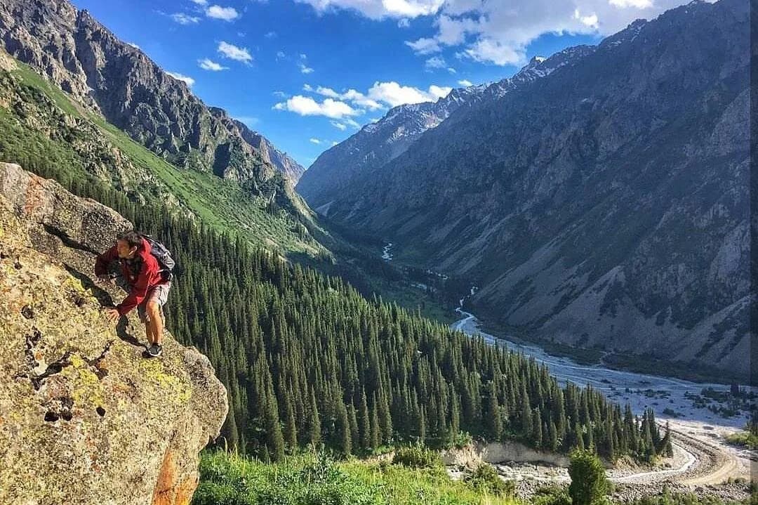
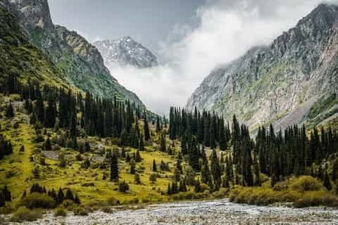
From the road head the trail climbs steadily up the valley. The first section runs through Tien Shan spruce forest — a distinctive dark, spiky conifer — and it is the part people underestimate: steep, rooty and often muddy, with the path braiding around fallen trees. You gain height quickly here.
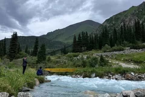
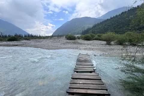
Expect river and stream crossings. The Kegety and its feeder streams run cold and, early in the season, fast with snowmelt, and the crossings are a mix of log bridges, boulder-hops and the occasional ford. None are technical in normal summer flow, but wet feet are likely and the footing is greasy, so trekking poles earn their place. In June, when the melt is at its peak, crossings are meaningfully harder and higher; by August they drop.
Above the treeline the forest gives way to open alpine meadow and then a moraine climb — loose rock and boulder the last push to the basin. It is a grind rather than a scramble, with no exposure or technical ground, but the altitude and the gradient together make the final stretch feel harder than the distance suggests. Then the lake appears, sudden and blue, cupped below the ridgeline. The standard round trip runs about five to seven hours depending on your pace, how far up the track your vehicle got you, and how long you linger.
Water is plentiful from the streams, but the whole valley is grazed by livestock in summer, so filter or treat everything rather than drinking straight from the river.
Day trip or overnight camp?
Both work. As a day trip it is a full, satisfying outing — leave Bishkek early, hike up and back, and you are home for a late dinner. That is how most people do it.
Camping by the lake turns it into something better if you have the gear. You get the water in evening and dawn light, the sky after dark, and a slower morning, and you skip the crowds that arrive mid-morning. There are no facilities of any kind at the lake — no hut, no yurt, no shop — so you carry everything, including a tent rated for a cold night and enough food. Nights are chilly even in July at this height, and rain or a dusting of snow is possible in any month. If you have never slept high before, read up on altitude first; the lake is not extreme, but the gain from Bishkek's ~800 m is real.
Season and snow
The usable window is roughly late June to September, with July and August the most reliable. Outside that, snow on the upper trail and moraine, plus high snowmelt in the crossings, turns a moderate hike into a slog or a hazard.
| Period | What to expect |
|---|---|
| May – mid-June | Snow lingering up high, forest muddy, crossings dangerously high with melt. Not recommended. |
| Late June | Usually clear enough to hike; expect fast, cold river crossings and some snow patches. |
| July – August | The sweet spot: warmest, driest, crossings at their lowest, lake fully thawed. Busiest, too. |
| September | Quieter, crisper, fine light; colder nights and shortening days. Early snow possible late in the month. |
| October – April | Snowbound and effectively closed to day-hikers. |
Whatever the month, plan around the mountain weather pattern: clear mornings, cloud building from late morning, and thunderstorms common in the afternoon. Start early and aim to be heading down before the weather turns. For the country-wide view, see when to visit Kyrgyzstan.
Combining with Kegety waterfall
The same gorge holds the Kegety waterfall, further up the main valley from the Kol-Tor turn-off. It makes an easy add-on for anyone who wants more from the drive, and it is a gentler objective than the lake — worth it if a member of the group would rather not tackle the full climb. Higher still, the Kegety pass (around 3,800 m) crosses the Kyrgyz Ala-Too to the Suusamyr side; it is a rough 4WD route open only in high summer and is a serious undertaking, not a casual extension. For most visitors the lake, or the lake plus the waterfall, is a full day.
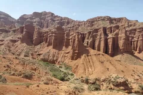
If this whets your appetite for Tien Shan hiking closer to the city, Ala-Archa National Park is the other great Bishkek day-hike, and the eroded red-rock Konorchek canyons make a completely different kind of outing to the east. A day in the capital itself is easy to pair either side of the trip — our Bishkek city guide covers the bazaars, cafés and museums.
What to bring
Waterproof, broken-in boots with good tread; trekking poles for the crossings and the moraine; a windproof and waterproof layer even on a fine forecast; sun hat and strong sun cream (UV bites at altitude); a water filter or purification; and plenty of food and water, because there is nothing to buy past the trailhead. If you are camping, add a warm sleeping bag and a tent that will shrug off wind and a cold night. A fuller checklist lives in our Kyrgyzstan packing list.
Kol-Tor rewards a bit of effort with one of the best lake-and-mountain scenes within a day of the capital. Plan the transport, respect the season, and get an early start. Ready to build it into a bigger trip? Browse trekking tours across Kyrgyzstan or read the wider trekking in Kyrgyzstan guide.
Chat with a real person — free
Seif and the team reply on WhatsApp 24/7 — trip questions, custom plans and booking help.
Ask Seif on WhatsAppCommon questions
Where is Kol-Tor Lake?
Kol-Tor is a small glacial lake in the Kegety (Kegeti) gorge, one of the valleys cutting south into the Kyrgyz Ala-Too range in Chuy province. It sits roughly two to three hours' drive east of Bishkek, above the Kegety river. Do not confuse it with the separate Köl-Tör above Kol-Ukok near Kochkor, in Naryn province, which is a different lake on a longer route.
How long is the Kol-Tor hike?
It is about 14 km return, or roughly 7 km each way, from the upper Kegety road head to the lake and back. You climb 700–900 m and most people take five to seven hours in total, depending on pace and how far up the rough track their vehicle reached. It is an out-and-back, so you return the way you came.
How hard is the Kol-Tor hike?
Moderate to hard. There is no technical ground, but the forest section is steep, rooty and muddy, the final moraine climb is loose and tiring, and you gain height quickly to about 2,700–2,800 m. River crossings add difficulty early in the season. Reasonably fit hikers manage it as a day trip; it is not a gentle stroll.
Can you drive to the Kol-Tor trailhead?
You drive to Kegety village on paved roads, then a rough track climbs the gorge to the road head. That last stretch needs high clearance, and four-wheel drive in wet conditions; an ordinary car may not make it and will leave you walking extra kilometres. There is no public transport, so hire a car, arrange a taxi or 4WD in the village, or take a guided day tour.
What is the best time to hike Kol-Tor?
Late June to September, with July and August the most reliable. Earlier than that, snow lingers on the upper trail and the river crossings run high and cold with snowmelt. September is quieter and crisper but brings colder nights and the risk of early snow. From October to April the route is effectively snowbound and closed to day-hikers.
Can you camp at Kol-Tor Lake?
Yes, wild camping by the lake is allowed and turns the trip into an overnight worth the extra effort for the light and the quiet. There are no facilities at all — no hut, yurt or shop — so carry everything, including a tent and a warm sleeping bag, because nights are cold even in July at this altitude. Many people do it as a long day trip instead.
Do you need a permit to hike Kol-Tor?
No. Kol-Tor is not in a border zone, so no trekking or border permit is required. You may be asked for a small local or entry fee at the gorge in some seasons, so carry a little cash in som just in case. Bring all the money you need from Bishkek, as there is nothing to pay with or buy once you leave the village.
Can you combine Kol-Tor with Kegety waterfall?
Yes. The Kegety waterfall sits further up the same gorge from the Kol-Tor turn-off and makes an easy add-on to the drive, gentler than the lake climb. Higher up, the Kegety pass at around 3,800 m crosses to the Suusamyr side, but that is a rough 4WD route open only in high summer and is a serious undertaking rather than a casual extension.
Is Kol-Tor a good day trip from Bishkek?
It is one of the best. Within two to three hours of the city you get a vivid turquoise glacial lake and a proper mountain hike, without committing to a multi-day trek. Start early to beat the afternoon weather and the weekend crowds, sort your transport in advance, and go in the July–August window for the easiest conditions and lowest river crossings.
Book it on This is Kyrgyzstan
Turn this guide into a trip
Kyrgyzstan's bestsellers
The experiences travelers book most, across the country



Keep reading
Self-Guided Treks in Kyrgyzstan: Routes & How-To
Yes, you can trek Kyrgyzstan without a guide. The best self-guided routes, the ones to skip, and the maps, water and safety logistics that make it work.
By TiK Editors12 min read
Uchitel Peak: Your First 4,000m Climb (2026)
Pik Uchitel (~4,400-4,600 m) in Ala-Archa is the classic first summit for fit hikers new to mountaineering: route, gear, season and acclimatisation.
By TiK Editors8 min read
Tian Shan Traverse: Bikepacking Kyrgyzstan
The Tian Shan Traverse is a self-supported, mostly off-road bikepacking route of about 1,000 km across the high Kyrgyz mountains. Here's how to plan it.
By TiK Editors9 min read