 Image via GetYourGuide
The Ak-Suu Traverse: Kyrgyzstan's Best Trek (2026)
The Ak-Suu Traverse links Karakol valley, Ala-Köl lake, a ~3,900 m pass and Altyn-Arashan's hot springs over 4–5 days. Route, costs and altitude, planned right.
Book it on This is Kyrgyzstan
Karakol · Turn this guide into a trip
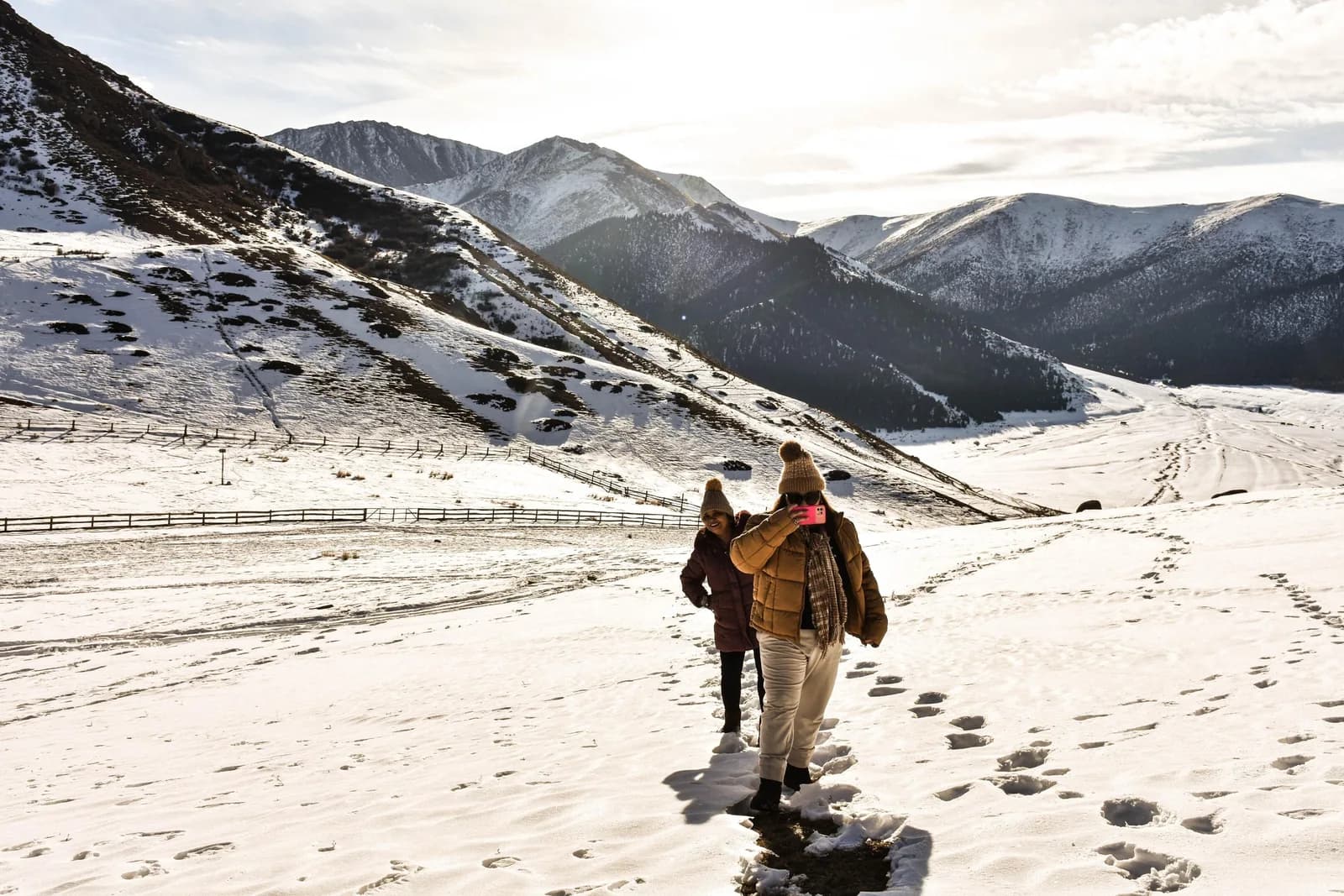
The Ak-Suu Traverse is a four-to-five-day high route above Karakol that links the Karakol valley, the glacial Ala-Köl (Ala-Kul) lake, a pass of roughly 3,860–3,900 m, the Keldike valley and the Altyn-Arashan hot springs, usually with the red sandstone of Jeti-Ögüz at one end. It is regularly called Kyrgyzstan's best multi-day trek, and the claim holds up: you cross a proper alpine pass, sleep beside a lake that changes colour by the hour, and finish soaking in a thermal spring under a 5,000 m peak. It is also genuinely hard, and the pass sits high enough to make altitude the thing most people underestimate.
This guide gives you the route day by day, how to reach the trailhead from Karakol, the honest difference between going guided and self-guided, and a clear-eyed word on the altitude. Prices are quoted in som and US dollars at roughly 87 KGS to the dollar; confirm the exact figure on the day, because trail-town rates have moved sharply upward since 2023.
At a glance
| Duration | 4–5 days (a 3-day core is possible; see below) |
| Distance | ~60–75 km for the full traverse; ~45–55 km for the Ala-Köl core |
| Max altitude | Ala-Kol pass, ~3,860–3,900 m (sources differ; never plan for less) |
| Elevation gain | ~2,400–3,000 m cumulative over the full traverse; confirm with your line |
| Difficulty | Hard. Not a beginner walk, despite its popularity |
| Best months | Mid-June to mid-September; the pass is reliably snow-free mid-July to mid-September |
| Permit | None needed; Karakol National Park entry is 250 som + 100 som per tent |
| Guided or self-guided | Both work. The main line is well-trodden but poorly waymarked in cloud |
The route, day by day
The "Ak-Suu" name comes from the exit: Ak-Suu ("white water") is both the river and the village (Soviet-era Teploklyuchenka, "warm springs") at the mouth of the Arashan valley, about 12–15 km from Karakol town. The full traverse starts west at Jeti-Ögüz, crosses into the Karakol valley over a high pass, climbs to Ala-Köl, drops over the Ala-Kol pass into the Keldike valley, reaches Altyn-Arashan, and walks out down the Arashan valley to Ak-Suu. Most operators sell it as five days; fit, acclimatised trekkers compress it into four.
Here is the five-day shape, with the Ala-Köl core measured on GPS by trekkers who have walked it:
| Day | Section | Distance | Gain | Grade |
|---|---|---|---|---|
| 1 | Jeti-Ögüz valley → upper-valley camp | ~12–16 km | +600–800 m | Easy–moderate |
| 2 | Over the connecting pass (~3,800 m) → Karakol valley | ~14–18 km | +900–1,100 m | Hard |
| 3 | Karakol valley → Ala-Köl lake camp | ~12 km | +600 m | Moderate–hard |
| 4 | Ala-Köl → Ala-Kol pass → Altyn-Arashan | ~16–18 km | +700 m, then long descent | Hard |
| 5 | Altyn-Arashan → Ak-Suu (Teploklyuchenka) | ~16–19 km | +180 m | Easy but long |
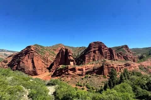
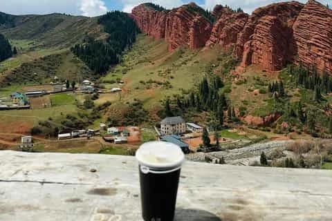
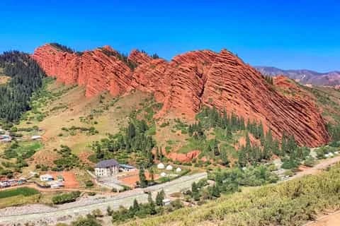
Day 1 — Jeti-Ögüz. Start at the Broken Heart rock and the Seven Bulls cliffs, the red sandstone formations that make Jeti-Ögüz worth a stop in their own right (there is a fuller Jeti-Ögüz guide if you want to build in an extra day). Walk up the green Jeti-Ögüz valley through spruce and summer pasture and camp high. It is a deliberately gentle first day that doubles as acclimatisation.
Day 2 — the connecting pass. The traverse crosses from the Jeti-Ögüz drainage into the Karakol valley over a pass of roughly 3,800 m; operators route it via the Archa-Tor or Telety line, so confirm the exact col and its height when you book. This is a big day with over a thousand metres of climbing and your first real taste of altitude. You drop into the Karakol valley near the Sirota camp.
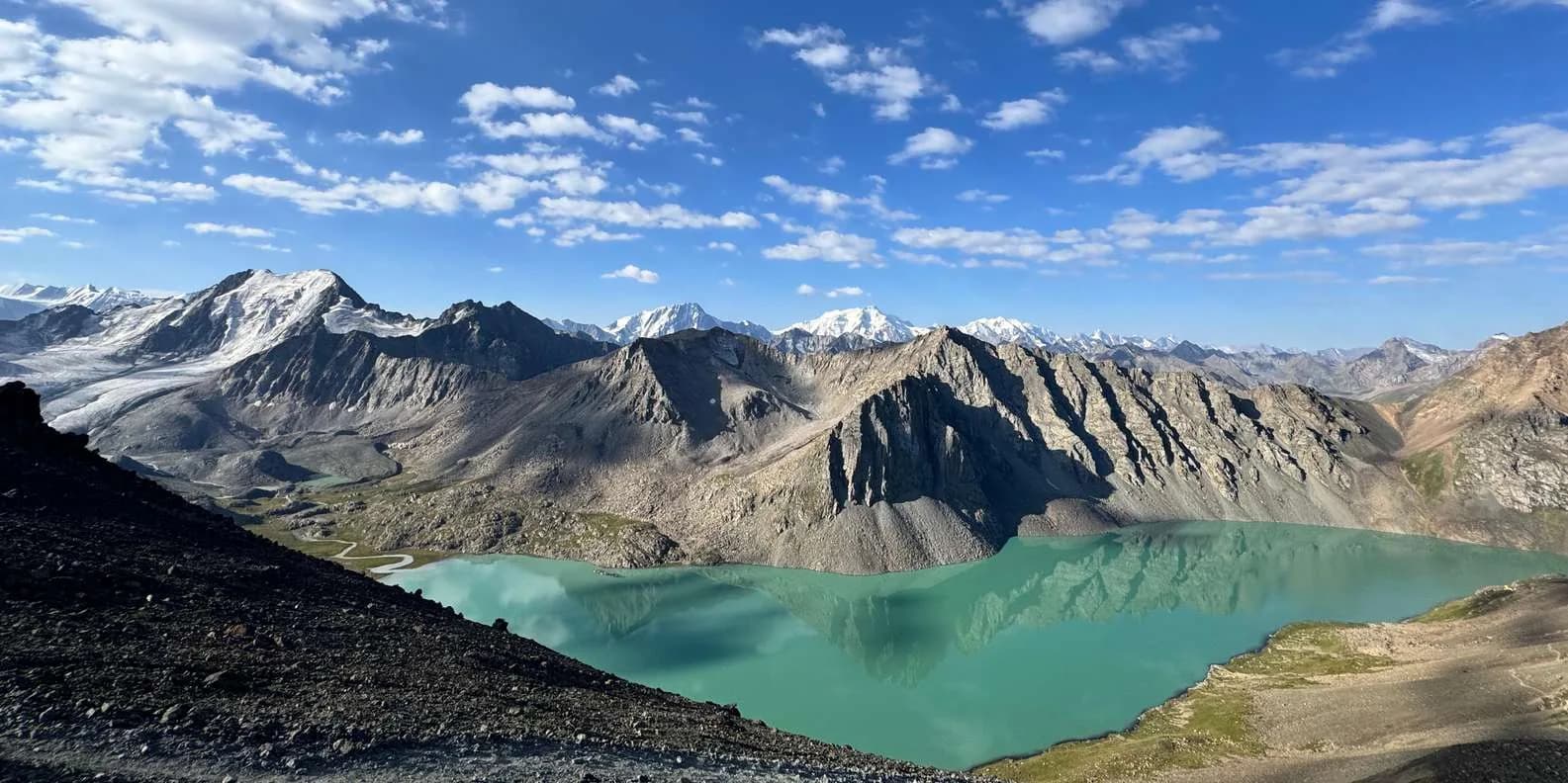
Day 3 — up to the lake. From the Karakol valley you climb steeply to Ala-Köl itself, sitting in a cirque at about 3,530–3,560 m. The colour is glacial rock flour in suspension: milky pale blue under cloud, intense turquoise-teal in direct sun, near-black at dusk. Camping at the lake is the sleep-high option and the best light for photography, but it is exposed and below freezing at night in any month.
Day 4 — the pass and the scree. The crux. You climb from the lake to the Ala-Kol pass at ~3,860–3,900 m, the trek's high point, then face the descent people underestimate: 600–700 m of loose scree and broken rock dropping east into the Keldike valley. Take the gravel "sliding" path rather than the steeper direct line, keep your poles out, and never descend directly above another party — rockfall onto the people below is the real hazard. The valley eases and delivers you to Altyn-Arashan, where a hot bath is waiting.
Day 5 — walk out to Ak-Suu. Altyn-Arashan ("golden spa") sits at roughly 2,400–2,600 m in the Arashan reserve. Soak in the springs, then follow the rough jeep track and the Arashan river down the valley to Ak-Suu, past spruce walls and, near the bottom, apple and apricot orchards and beehives. It is long and downhill on a rocky road; from Ak-Suu a marshrutka or taxi runs you back into Karakol.
The 3-day core. If Jeti-Ögüz doesn't fit your time, skip days 1–2 and start in the Karakol valley: park gate to Sirota (14 km, +905 m), then the big pass day Sirota → lake → pass → Altyn-Arashan (18 km, +1,125 m), then out to Ak-Suu (19 km, +182 m). This is what most Karakol agencies sell as the Ala-Köl trek, and it stands on its own. Adding Jeti-Ögüz turns a very good trek into the fuller traverse.
Getting to the trailhead from Karakol
Karakol (~1,700–1,770 m) is the base for everything here, and the last place with ATMs, gas canisters and a proper bazaar. Bring all your trek cash from town; there are no cards at the park gate, the yurts or the guesthouses.
For the Karakol-valley start, marshrutka 101 (about 10 som) runs towards the national park gate, and a shared 4x4 up to the Sirota bridge to cut the flat approach costs roughly 800–1,000 som per car. For a Jeti-Ögüz start you take a marshrutka or taxi south-west to Jeti-Ögüz village first. At the finish, marshrutka 350 (about 25 som) links Ak-Suu / Teploklyuchenka back to Karakol, or a taxi is around 1,000 som per car. The upper Arashan track itself is brutal — an ex-Soviet UAZ job, not something an ordinary car can drive. Karakol has plenty else to do on either side of the walk, from the wooden Dungan mosque to the Sunday livestock bazaar; see the Karakol guide and the wider getting-around notes for logistics.
Guided or self-guided?
Both are normal on this route. The main line is a well-trodden boot path with occasional cairns, and in clear weather it is easy to follow. The problem is that Kyrgyz trail marking is thin to non-existent, and the two places it matters most — the moraine above the lake and the pass itself — are exactly where cloud rolls in from late morning. In poor visibility, navigation stops being trivial.
Self-guided works if you are comfortable with a map and a GPS track. Download the route as GPX before you go, and carry it offline in Maps.me or Organic Maps (both OSM-based, and Ala-Köl, Altyn-Arashan and the Jyrgalan loops are all drawn on them). 2GIS is the best offline app for the towns and transport. If you want paper, the Austrian Alpine Club (Alpenverein) prints the best 1:100,000 sheets for the Terskey/Karakol area. Do not rely on phone signal — there is none in the upper valleys or at the lake.
Going guided buys you navigation in bad weather, a pack horse for the heavy loads, meals cooked for you, and someone who knows whether the pass is holding snow this week. Book through Destination Karakol, the local DMO, or a Karakol-based operator rather than a Bishkek agency if you want the money to stay in the valley. Either way, this is a serious mountain route; read the trekking-in-Kyrgyzstan overview before you commit.
Rough costs, all to confirm on the day:
| Item | Som | USD |
|---|---|---|
| Karakol NP entry + tent | 250 + 100/tent | ~$3–4 |
| Sirota yurt bed | 1,000–2,500 | ~$11–29 |
| Altyn-Arashan guesthouse, half board | ~2,100 | ~$24 |
| Self-supported 3-day trek (own food) | — | ~$50–80 |
| Guided group place | — | ~$150–250 |
| Private guide, whole trek | — | ~$200–350 |
Altitude: the pass is nearly 3,900 m
This is the part to take seriously. The Ala-Kol pass sits at roughly 3,860–3,900 m, and the standard itinerary builds in almost no acclimatisation: people arrive in Karakol from Bishkek (800 m), start walking, and are on the pass within a day or two. Altitude illness is the commonest reason trekkers bail here, and it is the trek where Kyrgyzstan's cases concentrate.
The rule that matters is sleeping altitude. Above 3,000 m, try not to raise where you sleep by more than about 500 m a day, which is one argument for the five-day traverse over a rushed three: the extra nights and the gentle Jeti-Ögüz start give your body more time. Spend two nights in Karakol before you begin, and never schedule the pass for the day after a Bishkek bus. A headache and a poor night's sleep at the lake camp are common and usually pass; confusion, loss of coordination, or breathlessness at rest mean descend now, not in the morning. Fitness offers no protection. Read the dedicated altitude-sickness guide before you go, and buy insurance that explicitly covers trekking to 3,900 m and helicopter evacuation, because there is no free, guaranteed mountain rescue and no phone signal to call for one. A satellite messenger is genuinely useful up here.
When to go
The broad window is mid-June to end September. The pass specifically is reliably snow-free only from about mid-July to mid-September; snow lingers into late July in a heavy year and can fall fresh on the pass in any month, including August. July and August are the most stable and have every service open; September is quieter and colder with better light, but some yurt camps start packing down by mid-month. Outside that window the route is mountaineering-grade, not a trek. The weather rhythm is worth planning around: clear dawns, cloud building from late morning, thunderstorms and graupel from early afternoon. Aim to be over the pass before about 11:00. For the wider seasonal picture, the best-time-to-visit guide is the place to start.
If this route sounds like your kind of walking, browse Karakol-based options on the trekking tours page and match a guided departure to your dates — or use it as the backbone of a longer Terskey Ala-Too trip.
Chat with a real person — free
Seif and the team reply on WhatsApp 24/7 — trip questions, custom plans and booking help.
Ask Seif on WhatsAppCommon questions
Is the Ak-Suu Traverse hard?
Yes. Despite its popularity it is a hard trek, not a beginner walk. The pass day involves over 1,100 m of ascent, most of it above 3,000 m, followed by a loose scree descent. Experienced Alpine hut-to-hut walkers manage fine; people whose longest previous outing is a day hike often struggle on the high day. Trekking poles, broken-in boots with good tread, and honest fitness all matter.
How high is the Ala-Kol pass?
Roughly 3,860 to 3,900 m. Sources genuinely disagree on the exact figure, so plan for the top of the range rather than the bottom. It is the highest point of the whole traverse — higher than the Ala-Köl lake, which sits in a cirque below it at about 3,530–3,560 m. At that altitude the air is thin enough that acute mountain sickness is a real risk, not a theoretical one.
Do I need a permit for the Ak-Suu Traverse?
No trekking permit and no border permit are needed for the Ala-Köl and Altyn-Arashan section. You do pay Karakol National Park entry at the gate, most recently 250 som per person plus about 100 som per tent, in cash. The Arashan side has its own collection point, so on a through-trek you can be charged on both ends. Carry small som notes; there are no card payments at the gates.
Can I do the traverse self-guided?
Yes, if you can navigate. The main path is well-trodden and easy to follow in clear weather, but waymarking is poor and the moraine above the lake and the pass itself get confusing in cloud. Download a GPX track and carry it offline in Maps.me or Organic Maps, take warm layers and a filter, and be ready to turn back. There is no phone signal in the high valleys, so a satellite messenger is worth carrying.
When is the best time to do the trek?
Mid-July to mid-September is the safe window, when the pass is most reliably snow-free. The broader season runs mid-June to end September, but early-season crossings can still meet snow and need an ice axe. July and August are busiest with every service open; September is quieter and colder with the best light. Fresh snow can fall on the pass in any month, so pack for winter conditions up high.
How do I get to the trailhead from Karakol?
For the Karakol-valley start, marshrutka 101 (about 10 som) heads towards the national park gate, and a shared 4x4 to the Sirota bridge costs roughly 800–1,000 som per car. A Jeti-Ögüz start means a taxi or marshrutka to Jeti-Ögüz village first. At the finish, marshrutka 350 (about 25 som) links Ak-Suu back to Karakol, or a taxi is around 1,000 som. Bring all your cash from Karakol — no ATMs beyond town.
What does the trek cost, guided versus self-guided?
Self-supported over three days with your own food runs about US$50–80 total. Joining a guided group is roughly US$150–250, and a private guide for the whole trek about US$200–350. On top of that, budget park fees (250 som plus 100 som per tent), a Sirota yurt bed (1,000–2,500 som) and an Altyn-Arashan guesthouse (around 2,100 som half board). Book through Destination Karakol to keep the money local.
Where do I sleep, and do I need a tent?
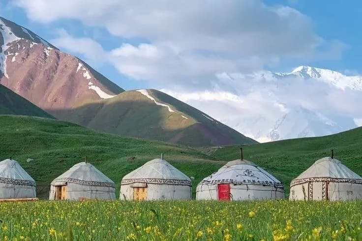
You can do the core route without a tent: yurts and fixed tents at Sirota in the Karakol valley, and guesthouses or yurt camps at Altyn-Arashan, open roughly May to October. Carrying a tent buys you a night camped at the lake and independence from bookings, which matters in August when beds fill and walk-in is not guaranteed. There is no resupply anywhere on the route, so buy all your food in Karakol.
How fit do I need to be, and what about altitude sickness?
You need to be comfortable walking 15–18 km days with a big climb and descent, at altitude. Fitness does not protect against altitude sickness, though — that comes down to how fast you ascend and how high you sleep. Spend two nights in Karakol first, take the five-day version if you can, and never do the pass the day after arriving from Bishkek. Headache and poor sleep are common; confusion or breathlessness at rest mean descend immediately.
Book it on This is Kyrgyzstan
Turn this guide into a trip
Kyrgyzstan's bestsellers
The experiences travelers book most, across the country
Keep reading
Uchitel Peak: Your First 4,000m Climb (2026)
Pik Uchitel (~4,400-4,600 m) in Ala-Archa is the classic first summit for fit hikers new to mountaineering: route, gear, season and acclimatisation.
By TiK Editors8 min read
Boz-Uchuk Lakes Trek from Jyrgalan (2026)
A moderate 2–3 day trek to a string of alpine lakes above Jyrgalan — quieter than Karakol's classics, with community yurts, horses and clear DMO rates.
By TiK Editors8 min read
Tian Shan Traverse: Bikepacking Kyrgyzstan
The Tian Shan Traverse is a self-supported, mostly off-road bikepacking route of about 1,000 km across the high Kyrgyz mountains. Here's how to plan it.
By TiK Editors9 min read