Jyrgalan's signature three-pass loop is a walking trek with pack horses. You ride only once: across the Tüp river, which has no bridge.
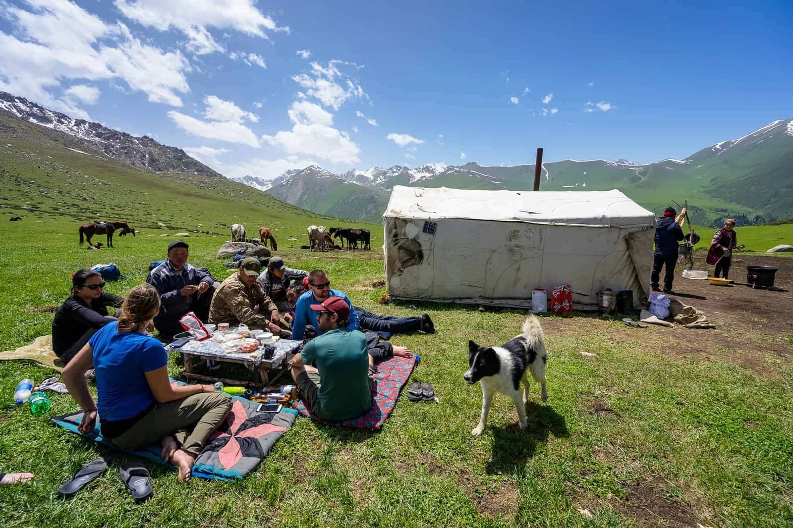
Keskenkija Loop
Walked, not ridden — the horses carry the bags and ferry you across the river
Jyrgalan valley, Ak-Suu district, Issyk-Köl province · from Jyrgalan
- Duration
- 4 days / 3 nights
- Distance
- ~44-64 (published figures vary by variant) km
- Max altitude
- 3,375 m
- Difficulty
- moderate
- Best months
- June to September. June still holds snow patches; August is the clearest.
- Riding experience
- none
- Price
- No package price published. Independent hire in Jyrgalan: pack horse 1,300 som/day (~US$15), horse guide 2,000 som/day (~US$23), Russian-speaking guide 2,000 som pp/day, English-speaking guide 2,500 som/day plus extras, cook 1,500 som/day, meals 350 som per person per meal. Gear rental runs about US$2-5 a day per item. Confirm on the day.
- Permit
- No
Chat with a real person — free
Seif and the team reply on WhatsApp 24/7 — trip questions, custom plans and booking help.
Ask Seif on WhatsAppAbout the Keskenkija Loop trek
Be clear about the format before you book, because the name misleads. Keskenkija is a trekking tour, not a horse trek: horses come along as porters, carrying up to 60 kg per two people. You walk. The one time you sit on a horse is the Tüp river crossing on day two, where there is no bridge and riders are ferried over — and that crossing is the genuine hazard of the route, with strong rapids, slippery submerged rocks and icy water. If you want days in the saddle, this is not it. As a walk it is excellent: a four-day loop out of Jyrgalan village over three passes between 3,310 and 3,380 m, through shepherds' roads, forest, high jailoo and alpine plateau, camping all three nights. Distances vary between 44 and 64 km depending on the variant. Practical notes: cattle make the water unsafe to drink, so carry purification; the route is marked with red paint arrows but some sections are sparse, so download offline maps; nights at the 3,200 m camp drop below freezing; and horseflies are a real nuisance in late August, so wear proper trousers rather than leggings.
Day by day
| Day | Route | Hours | Sleep |
|---|---|---|---|
| 1 | Jyrgalan village → The fork where the Jyrgalan Pass valley meets the Tuz gorge2,260 m to 2,970 m, +710 m, on a shepherd's road through the Eki Chat valley. | 8 walking, 18 km | tent |
| 2 | Tuz gorge camp → Meadow on the north side of the Tüp river2,700 m to 3,332 m over the Jyrgalan pass. The Tüp river is crossed ON HORSEBACK — there is no bridge, the rapids run strong, the submerged rocks are slippery and the water is icy. | 6 walking, 10 km | tent |
| 3 | Tüp river camp → High valley camp by a stream at about 3,200 mHigh point about 3,380 m. Forest, nomadic jailoo and alpine plateau. | 7 walking, 15 km | tent |
| 4 | High valley camp → Jyrgalan villageOver the Anvar pass at 3,310 m, descending through gorges and forest. | 8 walking, 20 km | guesthouse in Jyrgalan |
Included
- local guide
- cook
- pack horse, up to 60 kg per two people
- camping gear — tent, sleeping bag, poles
- all food
Not included
- not itemised by the destination organisation — confirm before booking
A route track for planning only — treat it as an approximate line, and always ride with a local guide.
Frequently asked questions
When is the best time for the Keskenkija Loop trek?
The best time is June to September. June still holds snow patches; August is the clearest.. Outside the season the high passes are snowbound and the summer yurt camps are packed down, so most operators only run it then.
How long is the Keskenkija Loop trek?
It runs 4 days / 3 nights and roughly 44-64 (published figures vary by variant) km, reaching about 3375 m. Difficulty is moderate.
How much does the Keskenkija Loop trek cost?
No package price published. Independent hire in Jyrgalan: pack horse 1,300 som/day (~US$15), horse guide 2,000 som/day (~US$23), Russian-speaking guide 2,000 som pp/day, English-speaking guide 2,500 som/day plus extras, cook 1,500 som/day, meals 350 som per person per meal. Gear rental runs about US$2-5 a day per item. Confirm on the day. Prices vary by group size, season and operator, so confirm current rates when you enquire.
Do you need riding experience?
No prior riding experience is needed — the Kyrgyz horses are calm and sure-footed and guides keep the pace gentle. You should be reasonably fit and comfortable spending several hours in the saddle.
How do you book the Keskenkija Loop trek?
Enquire on WhatsApp with your dates and group size, and we arrange the guide, horses, yurt nights and transfers. In July and August it's worth booking a day or two ahead.
Book the Keskenkija Loop trek
Tell us your dates and group, and we’ll arrange the guide, horses and yurt nights, plus the yurt stay at the end.
Chat with a real person — free
Seif and the team reply on WhatsApp 24/7 — trip questions, custom plans and booking help.
Ask Seif on WhatsApp